Next walk: June 7th -- Llanwrst - Conwy Valley
Details available as of 29th May
Number of places on coach Last few available...
The June walk takes us to Llanwrst in the picturesque Conwy Valley, as usual there will be three walks of differeing ability, those being the A, B & C walks.
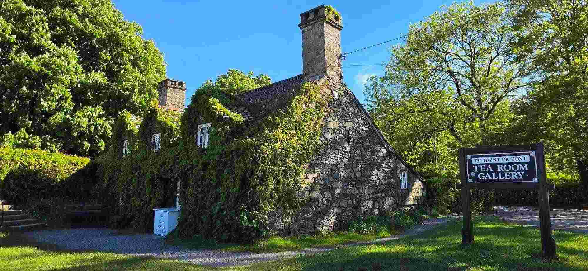
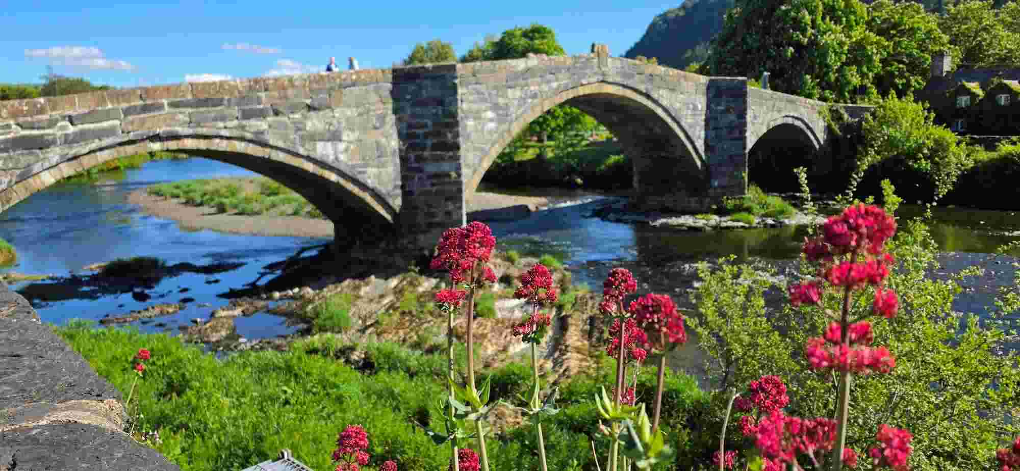
Llanwrst has numerous hospitality venues from friendly Welsh pubs to tearooms such as the famous iconic Ivy covered "Tu Hwnt I'R Bont Cafe" situated on the River Conwy next to the "Pont Fawr (Inigo Jones Bridge)" conveniently close to "Gwydyr Car Park" in which we have been advised to park, and the most likely parking spot for the bus, (to be confirmed by walk leaders)
I am informed by Llanwrst town council that Conwy Borough Council are currently refusing to finance the newly built toilets situated in Gwydyr Park, and where unable to say if they would be open for the summer season or not, therefore please make full use of our stop at Chester services on the M56 enroute, and before leaving please use the facilities in the local pubs & T Shops.
| Walk |
Leader(s) |
Plan/Recce report |
| A |
Derek Hesketh |
A Walk - Circular
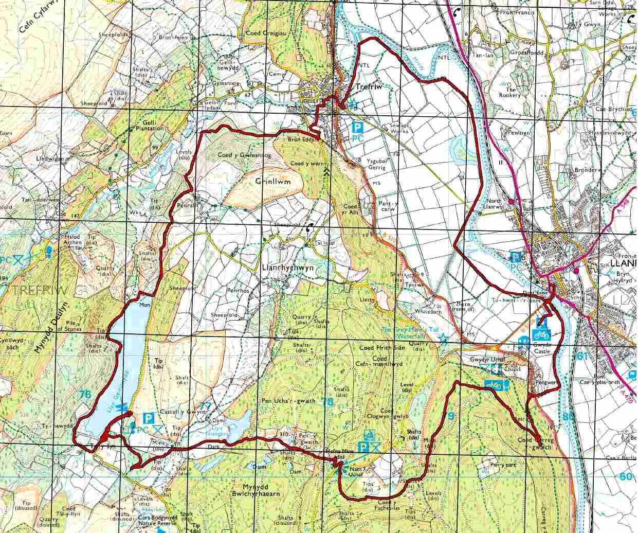
A walk Llanwrst 10/11 Miles - Ascent = approx 1100 ft (2 miles total climbing in first 4 miles mostly)
Leader Derek Hesketh
Circular from Llanwrst, approx 10/11 miles, shorter than recent A walks but does include some gentle climbing up through Gwydyr Forest on good forestry roads and trails.
The climb is amply rewarded when we reach the remains of "Hafna Mine" From the mine we pass Llyn Glangors before dropping down a little to the fabulous Llyn Geirionydd, a great location for lunch. Weather permitting we follow the western trail along the Llyn before dropping back down through the woods to Trefriw then back along the River/Afon Conwy back into Llanwrst.
|
| B |
B - Richard Duckett |
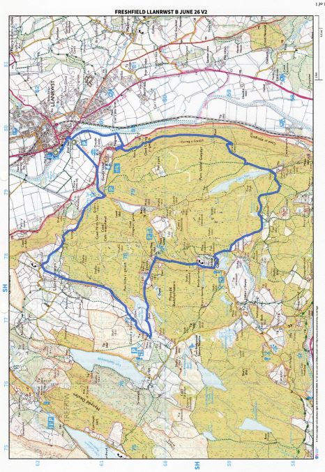
Freshfield Ramblers B Group Llanrwst June 26
14.5Km/9m along , 472m up.
The walk is mostly on forest paths or very minor roads, fairly easy underfoot, with a few well-maintained stiles. Splendid views in places. Several dried up lakes, and the usual mining remains. Completely dry on day of recce. No slutch. Some small sections might be a bit scratchy on bare legs. A treat for fans of wild flowers.
Richard & Terry
.
.
|
| C |
Phil Lally |
Llanrwst C Walk June 2026
In terms of historical interest this is probably one of the most impressive walks on our agenda.
The town of Lanrwst boasts buildings and structures that span the centuries; a circle of standing
stones lays within sight of a three arched bridge, designed by Inigo Jones in 1636, alongside a
15th century courthouse, now a National Trust coffee shop. Further into the walk there is an
imposing church, rebuilt in 1880, adjacent to a 17century Chapel.
Enough of the history lesson , and lets turn our minds to the geography of our walk.
We start in the centre of the town cross the River Conwy and amble southward along the side of
its waters until we meet a gateway that leads across a meadow to the woodland of the Gwydyr
forest. We stroll upwards along paths and tracks of this forest, taking in the succession of fine
views over the Conwy Valley.
Possibly the most picturesque sight of our whole walk is the exceptional twin waterfall called
Grey Mare'sTail. Here to catch the beauty of this wonder we have to descend down some
reasonably steep steps. Perhaps walking sticks might be recommended at this juncture.
From here we traverse over open ground to the village of Trefriw, noted for its Woollen Mills,
sadly closed on Sundays.
On leaving the village, under the comforting views of the Gwydyr Forest we follow the banks and
adjacent pathways alongside the River retracing our way back to Llanrwst, the NT coffee shop
and Inigo's masterpiece.
The walk is about 7 and a half miles long, mostly along banks of the river, woodland track,s gentle
meadows and few, if any, difficult hazards.
All in all a very pleasant days walk!
|
Llanwrst
 Click here for more memories..